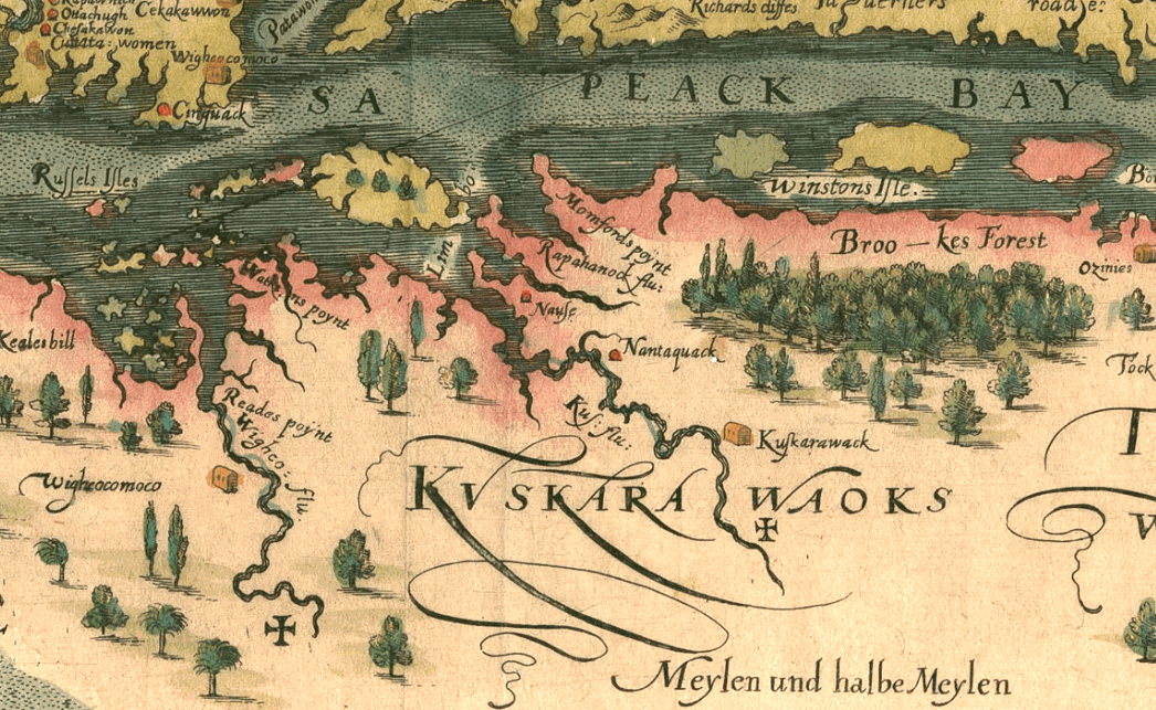
Capt. John Smith's Map of the Chesapeake Bay, Published in 1612

| This map was first issued in 1612 and became the standard for navigation and use by the King of England to grant land. The map was a good resource for the Crown to carry out its various duties. This map was probably the most reliable until at least 1673, when Augustine Hermann's Map appears. The Smith map is important in the geographical study of Native American settlements in the early 17th century. The Smith Map records 166 Indian Villages in the region and is a source for many Archaeologists today. It is incredibly accurate considering there were no aerial photographs, or sophisticated surveying instruments. This map is important to locating the territory of the Pocomoke Indian Nation and its towns and Village. On the map above take note of the word Kuskarawaoks which is located in the center of the Pocomoke Paramountcy. This would indicate that the Pocomoke People were probably associated with Nantaquak (Nanticoke) people on the River of the same name. History indicates that both groups spoke the same language. According to historic records of the Pocomoke Nation the main village and center of the Paramountcy was located on the east side of the Pocomoke River. Smith's map shows a main village named Wighcocomoco (Pocomoke today) on the east side of Wighco Flu. The cross on the map indicates that Smith sailed this far north on the Pocomoke River. The river in the center of the map was called Kus Flu and at the head of the river the village marked as Kuskarawack (aka Nanticoke People today). |
gold Back to Home page